
Students research former sawmill redevelopment to support forest management
Quick Summary
- Our team of EPM graduate students worked with three external clients to identify former sawmill sites in California that could be redeveloped into wood processing facilities to support sustainable forest management, rural economies, and climate resiliency
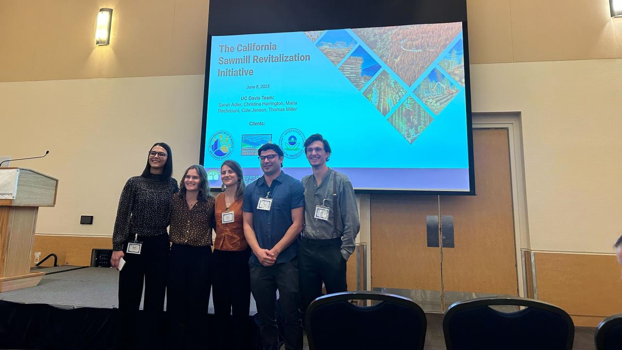
This blog is the third in a series of seven, where Environmental Policy and Management students write about the capstone projects they have worked on since January in partnership with external organizations. We want to acknowledge and thank our clients, the Watershed Research and Training Center, U.S. Environmental Protection Agency Region 9 and California Governor's Office of Business and Economic Development for partnering with us for this project.
How can we use wood waste in ways that support rural communities, fight climate change, and strengthen wildfire resiliency?
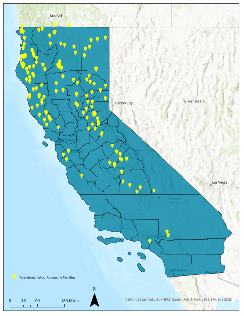
As part of a statewide effort to address catastrophic wildfire and support rural communities, our EPM team leveraged skills in geographic information systems (GIS), stakeholder engagement, and policy evaluation to assess the revitalization potential of 208 former sawmill sites in California. Our team - EPM graduate students Sarah Adler, Christina Harrington, Cole Jenson, Thomas Miller, and Maria Rechdouni and three clients the Watershed Research and Training Center, U.S. Environmental Protection Agency, Region 9, and the California Governor's Office of Business and Economic Development - collaborated to identify former sawmill sites that could be redeveloped into facilities that convert forest wood waste into a variety of products, like construction materials for housing, electricity, or biofuels.
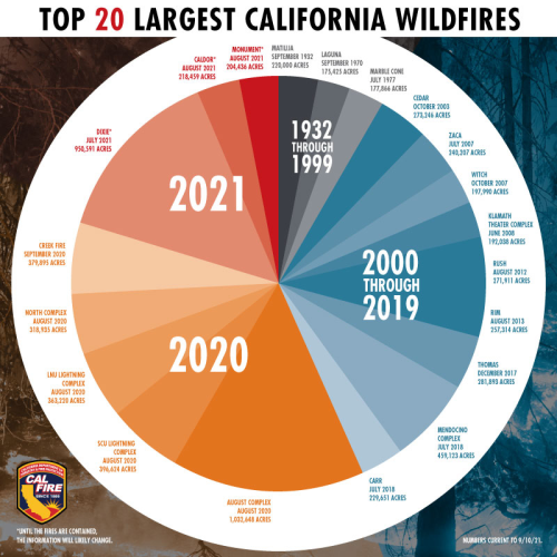
In 2020, wildfires claimed 33 lives and burned 4.3 million acres in California - more than twice the acreage burned in the state’s history since European colonization. Decades of misguided forest management practices, fire suppression, pest damage, and drought have led to an unnatural build up in forests, contributing to catastrophic wildfires that impact ecosystems, threaten rural communities, degrade air quality, and intensify climate change.
California and the U.S. Forest Service committed to jointly thin 1 million forest and wildland acres annually to reduce wildfire risk. California’s historically booming lumber industry declined in the mid to late 1900s, leaving the state with a lack of infrastructure to treat the estimated annual production of 15.1 million bone dry metric tons of biomass. Without means to utilize this biomass, low-value small-diameter trees remain in forests where they heighten fire risk, or are burned in open piles that release carbon, worsen air quality, and bypass the opportunity for creating useful wood products.
To address the problem, we used qualitative and quantitative data to evaluate former sawmill sites. Data captured environmental, social equity, and policy considerations, such as air pollution, unemployment, forest biomass, and public investment priorities. We engaged public agencies, community-based organizations, wood products experts, and city staff working in rural communities to shape how we approached our analysis.
After a five-month project timeline, we produced a report that includes:
- Methods and step-by-step guide to use GIS to focus on sites based on social justice and environmental conditions.
- An evaluation matrix with environmental, policy, and social conditions that we used to evaluate and score the redevelopment potential for 9 former sawmill sites
- A guide with practical questions and resources for residents and organizations in rural communities that want to pursue public funding to support site clean up.
- A comprehensive evaluation of how public policies influence site redevelopment.
Find the final report below and reach out to us. We’d love to answer questions and talk about how we can move this work forward.